Note: Creating Surveys is currently available on Tablet app & Web only, but will soon be available on the Phone app.
Start New Survey
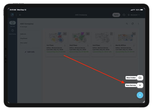
- Navigate to the Site Overview Screen.
- Press the + button in the bottom right corner.
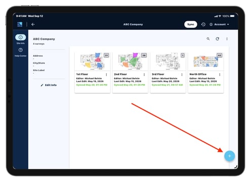
- Select New Survey.
1. Choose an import option for your floor plan:
- Photo Gallery: Select an image from your device’s photo gallery.
- Camera: Take a photo with your device’s camera and create a Survey from it directly.
- Satellite Image: Use Google Maps to create a floor plan using an aerial satellite image.
- Local Files: Select a floor plan image from your device’s local storage.
- Quick Start: Create a blank Survey.
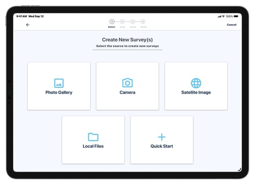
Tip: When selecting the Satellite Image option, Google Maps will automatically set the scale for your floor plan.
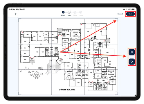
2. Crop Floor Plan
After selecting your floor plan image, the Crop screen will appear.- Crop your floor plan by dragging the corners of the frame to the desired area.
- Rotate the floor plan with the controls on the right-hand side.
- When done, tap Next in the upper right corner
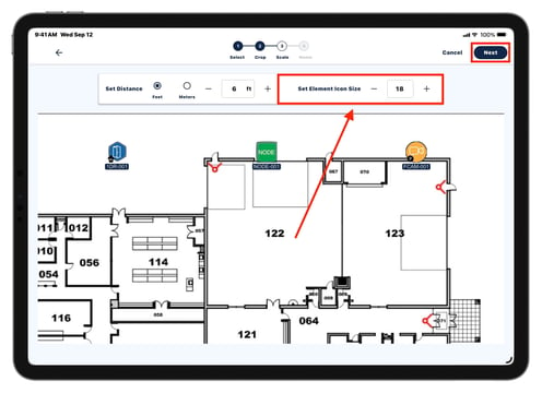
3. Set Survey Scale
Setting the scale is important for getting accurate measurements for your devices and Bill of Materials. Users can reset the scale on the Survey at any time after creating the Survey.
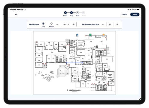
- Drag and drop the blue measuring tool to an area of your floor plan where the distance is already known.
- Doorways and hallways are commonly used for this.
- Type the distance into the Set Distance box and choose your unit of measurement.
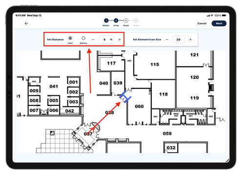
- Configure the Element Icon Size to the right of the Set Distance section.
- When finished, tap Next.
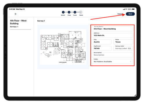
4. Name Survey
Name the Survey and enter location information.
- Enter the Survey Name
- Optionally, enter address information, Survey Label, description, and choose a folder.
- Tap Next to create your Survey and begin editing.